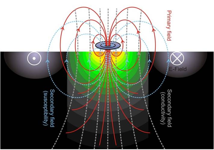
Technique: Marine Electromagnetics (EM) is an emerging active method to detect seabed potential field anomalies at different scales. These data help to assess hydrocarbon and mineral reservoirs, fresh water seeps or melting zones. We developed the benthic EM profiler MARUM Neridis III to map the magnetic susceptibility and electric conductivity of the surficial seabed sediments to deduct their composition, porosity, stratification and formation conditions.
Marine CSEM induces and measures secondary magnetic and eletric fields in the seafloor
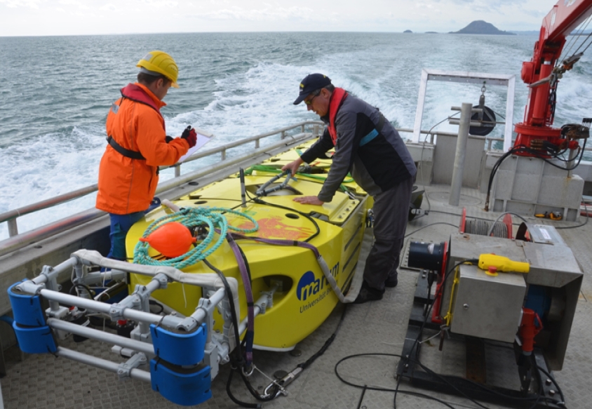
System: NERIDIS III (NERitic DIScoverer) is a new controlled-source electromagnetic (CSEM) benthic profiler developed and owned by MARUM. We modified a commercial land CSEM sensor for submarine application, which was mounted into a very robust nonconductive and nonmagnetic bottom-towed hull of 5.2 m length, 1.2 m width and 0.8 m height weighing 900 kg in air and 200 kg in water. Its primary purpose is meter-scale resolution EM sounding and mapping of the shallow seabed at water depths from 10 m (sublittoral) to 1000 m (upper slope). Magnetic susceptibility is determined from the sensors 75 Hz in-phase response (90% signal originates from the top 50 cm), while electric conductivity is derived from the 5 kHz out-of-phase (quadrature) component (90% signal from the top 92 cm). The system is also equipped with a CTD sensor and a new high-speed flash camera system to create continuous high-resolution optical sea-floor still images with ultrashort (0.1 ms) LED flash exposure. Using onboard Li-ion batteries, underwater deployment times of 8-12 hours can be achieved. With tow speeds of 3-4 knots, profile lengths of 20-40 nm can be achieved in one operation. Two lift bags in bow and stern inflate automatically and lift the system to the surface for easier recovery at sea or for autonomous ascent after accidential tear of the tow line in case of a hard collision with a seabed obstacle.
Neridis III getting ready to survey the Bay of Plenty
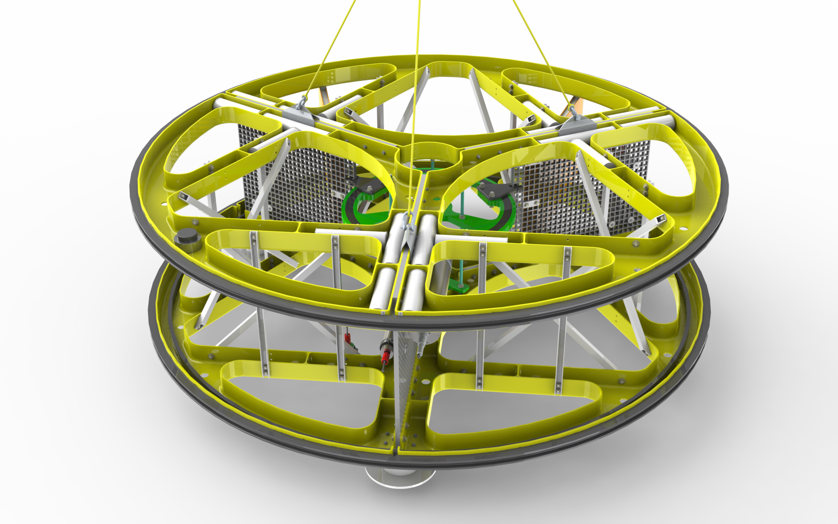
System: Controlled Source Electromagnetic (CSEM) imaging is a very promising method to explore marine resource of contrasting electrical conductivity and/or magnetic properties, e.g., Submarine Massive Sulphides (SMS), manganese nodules, phosphorites or heavy mineral placer deposits. However, the marine CSEM induction method demands spatially stable, operational robust and highly mobile sensor geometries of relatively large diameters, which has not been realized so far, especially not for deep-sea setting. On behalf of the German federal institute for mineral resources (BGR) we develop and built the CSEM platform “GoldenEye” providing an electromagnetic transmitter loop of 3.5 m in diameter on a robust fiberglass platform designed for both shallow water and deep sea applications from 10 m down to 5000 m water depth. The system features also video monitoring of the surrounding ecosystem to be used for damage prediction in the case of later ore extraction. It has been successfully deployed on two BGR RV Sonne cruises.