Methods and instruments of marine and field magnetics Team:Thomas Frederichs, Tilo von Dobeneck Room: University of Bremen, GEO Building, Room 0100
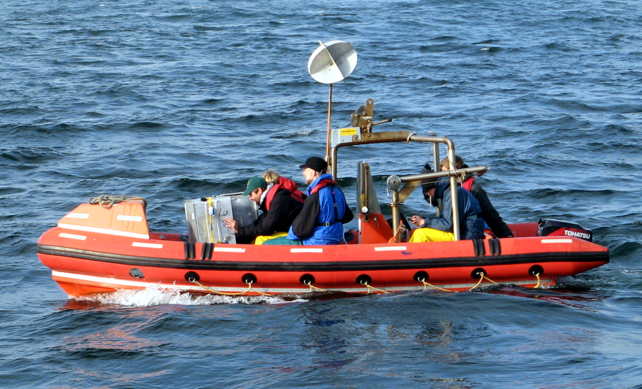
Techniques: Equipped with modern Overhauser magnetometers and gradiometers, we can conduct magnetic surveys at land and in the shallow sea. We also command over professional software for field data processing and interpretation. These systems are extensively used in our field courses and study projects, e.g. for archeological, structural, engineering and marine geology topics.
Magnetic survey training in the Baltic Sea
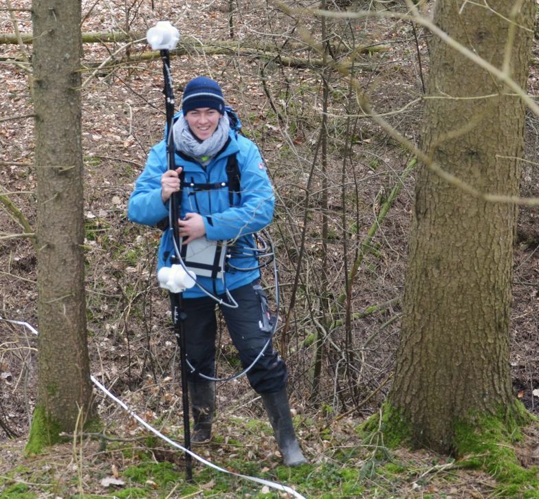
Portable Overhauser Magnetometer/Gradiometer GEM Systems GSM 19 Team:Thomas Frederichs, Tilo von Dobeneck Room: University of Bremen, GEO Building, Room 0100
System: We possess four portable GEM GSM-19 Overhauser magnetometers/gradiometers for spatial mapping of the total intensity and (vertical) gradient of the magnetic field. Three of our instruments are equipped with integrated GPS receivers. All have two omnidirectional sensors (i.e. no dead zones) and fast sampling rates of up to 5 Hz.
The GSM-19 units can be deployed in mobile (rover, fish) and stationary (base station, overvatory) mode and are particularly suited for small (1-100 m) and medium (100 m -10 km) scale terrestrial applications, for example to map magnetically contrasting rocks (e.g. volcanics, ores) and structures (e.g. pipelines, ammunition, foundations, graves) under soil and sediment cover.
Technical specifications:
Sensitivity: 0.022 nT @ 1 Hz, (0.015 nT option)
Resolution: 0.01 nT
Absolute Accuracy: +/- 0.1 nT
Dynamic Range: 20,000 to 120,000 nT
Gradient Tolerance: Over 10,000 nT/m
Sampling Intervals: 60+, 5, 3, 2, 1, 0.5, 0.2 sec
Operating Temperature: -55°C to +50°C
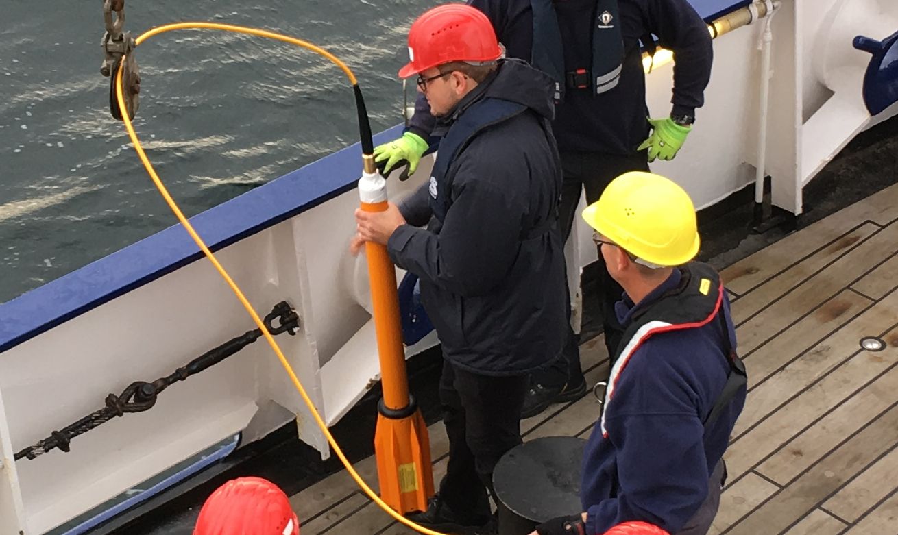
Marine Overhauser Magnetometer GEM Systems and Marine Magnetics Explorer Team:Thomas Frederichs, Tilo von Dobeneck, Location: University of Bremen, GEO Building, Room 0100
System: One of our GSM-19 may be operated in marine mode for which two floating bodies ('fishes') with Overhauser sensors inside instead of the conventional sensors are used. The available cables length of 30 m allows for magnetic surveys on lakes, rivers and inshore areas using small boats.
By courtesy of Jacobs University Bremen we operate a Marine Magnetics Explorer Magnetometer which is designed for a maximum water depth of 300 m. The standard cable length of 50 m limits its use to smaller boats. The Explorer magnetometer may be used for inshore geophysical surveys, archaeology, wreck detection, magnetic mapping of harbours and ferrous target detection in lakes, rivers and estuaries. In order to extent the range of use to larger vessels, a 240 m long cable is available as well.